Drones Are Becoming as Common as Hard Hats on Construction Sites
Drones have moved from executive toy to jobsite necessity. Here's where they're making the biggest impact and what's still catching up.
From novelty to necessity: how unmanned aerial systems quietly became indispensable on modern job sites.
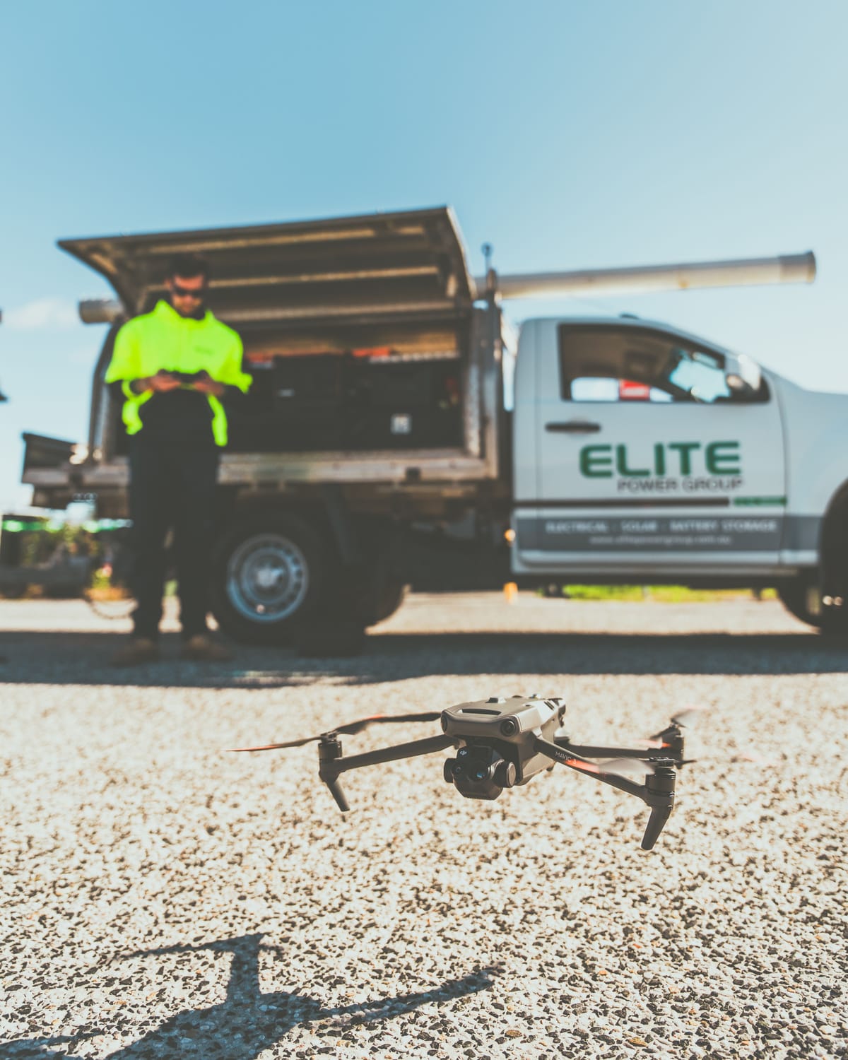
Walk onto almost any mid-size construction project in 2026 and there's a good chance you'll hear the faint whine of rotors before you see them.
Drones, once treated as executive toys or gimmicky marketing tools, have quietly become standard equipment on job sites across North America. Not because the industry fell in love with new technology for its own sake, but because the economics finally made sense.
The Job Site Data Problem
Construction has always been a information intensive industry running on paper processes. Project managers, site inspectors, and subcontractors process large amounts of data daily, such as progress updates, change orders, safety logs, material counts, and much of it still moves through approval chains, printed reports, and verbal check-ins.
As projects grew larger and more complex, the gap between the speed of construction and the speed of information became impossible to ignore. A site spanning 40 acres changes constantly. By the time a traditional inspection report makes it to a project manager's desk, the site may have already changed. And thus, decisions were being made on outdated information.
Drones didn't solve every problem in construction. But they solved this one.
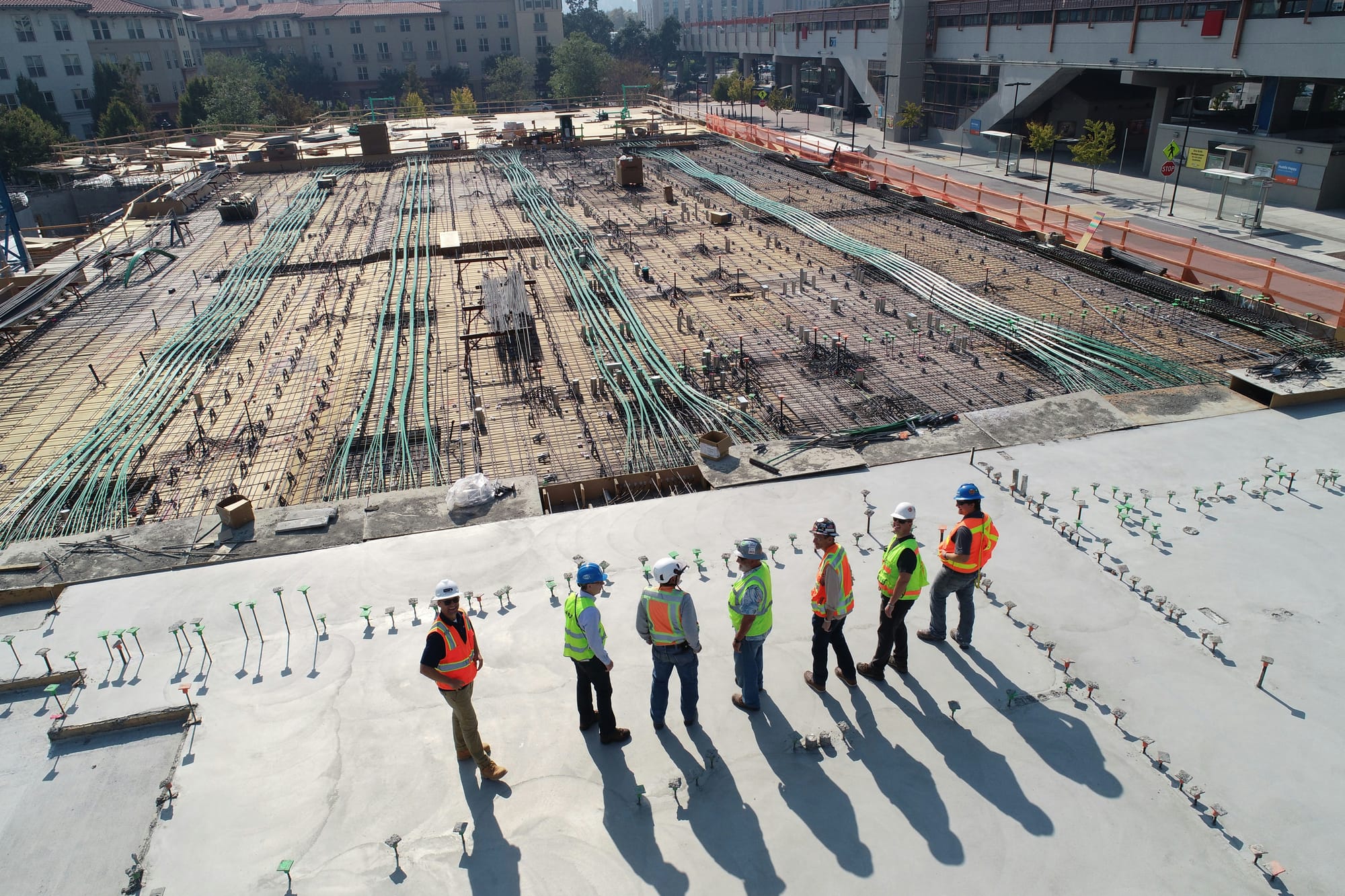
Where Drones Are Making the Biggest Impact
Surveying and Site Analysis
Traditional topographic surveys for large sites can take a team of surveyors several days and cost tens of thousands of dollars. Drone-based photogrammetry, capturing hundreds of overlapping images and stitching them into precise 3D models, can deliver the same output in a single day with a single operator.
The accuracy is now sufficient for earthwork calculations, drainage planning, and design coordination, which has made the technology standard practice on greenfield projects of almost any significant size.
Tracking What Actually Got Built
One of the persistent pain points in construction has been reconciling what was designed with what was actually built, especially in underground or concealed work. Drone captured data before and after pour, combined with accurate GPS tagging, gives contractors and owners an objective record. It's not just convenient for project closeout; it's increasingly being used in disputes and insurance claims where documentation matters.
Inspections Without Disruption
The traditional approach to roof inspections, facade surveys, and tower checks meant scaffolding, swing stages, or abseiling crews, which are expensive, slow, and not without risk.
A drone can inspect the same element in a fraction of the time, with imagery detailed enough to identify specific defects. Several large general contractors and specialty trades have reported reducing inspection time on complex envelope work by more than half after integrating drones into their quality control workflows.
Stockpile and Inventory Management
On projects where bulk materials, sand, gravel, crushed stone, represent significant cost exposure, manual measurement of stockpiles has always been approximate at best.
Drone captured topography, processed through volumetric analysis software, gives contractors far more accurate inventory data. That translates directly into purchasing decisions and reduces the kind of over-ordering that eats into already thin margins.
Safety Monitoring
Drone collected thermal and visual data is being used for more than progress tracking. Several firms have begun routine thermal sweeps of active sites to identify heat stress zones for workers, detect equipment overheating before it becomes a breakdown, and document safety conditions for regulatory compliance reviews. It's not replacing good safety practices, but it's giving site managers visibility they never had before.
What Took So Long
Drones have been commercially available for over a decade, so why did adoption in construction take so long? The technology was ahead of the regulatory environment, and the regulatory environment was ahead of the workflow integration. A drone that can capture good data is one thing. A construction firm that can consistently turn that data into decisions is another entirely.
The FAA's Part 107 certification created a clear path for commercial operators, and software tools matured to the point where processing drone data no longer required a photogrammetry specialist. But the real inflection point was when the data started flowing into systems firms were already using project management platforms, BIM tools, estimating software, rather than existing in isolation.
That's the shift that's accelerating now.
What's Still Catching Up
Despite rapid adoption, significant gaps remain. Data management is the most common pain point cited by contractors and service providers alike. Flights generate large volumes of imagery and point cloud data that need to be organized, stored, and made accessible to the people making decisions, not just the pilot who ran the mission.
Another challenge is standardization. When one subcontractor captures data one way and another uses a completely different workflow, combining datasets becomes painful. The industry is moving toward common formats, but adoption is uneven.
And on the regulatory side, the framework for beyond visual line of sight (BVLOS) operations, which would allow drones to cover much larger sites without a ground based observer is still evolving. Several companies are operating under waivers, but widespread BVLOS approval would significantly expand what's economically feasible for large infrastructure projects.
The Bottom Line
Drones are no longer a differentiator in construction, they're becoming table stakes. The firms that adopted early have had time to work out their workflows, train their teams, and build the data habits that make the information useful. The firms that are coming into the technology now face a steeper climb, but benefit from better tools and proven use cases.
The question for 2026 isn't whether to use drones. It's whether your organization has the systems in place to turn the data they generate into actual decisions.

Related reading
Continue the thread.
Related posts are pulled from the same primary topic as the current article.
The Drone Industry Map Just Hit 1,413 Companies: What That Means For Operators
Drone Industry Insights' 2026 Drone Market Map catalogues 1,413 companies across 70 countries and adds base stations and charging pads. The signal for operators is not just growth. It is the move from pilots in the field to fleets, docking infrastructure and repeatable operations.
Kazakhstan's Alatau City UAM Project And What It Signals For Drone Delivery In Central Asia
Alatau City's UAM project is not yet a proven commercial drone-delivery network, but its test center, partner mix and city-planning approach make it a serious signal for Central Asia.
How Drought-Stressed Forests Are Becoming A Drone Mapping Vertical
Drought, insects and disease are pushing forest managers toward better spatial data. Drones will not replace aerial detection surveys, but they can add high-resolution detail where decisions are local.